|
¿Ya Llegamos? (Are We There Yet?)
Hiding in Plain Sight - Part 3
By Alexander D. Bevil, California State Parks Historian II (Retired)
March/April 2026
More than lines on a map, these historic trails have been associated for nearly a century with tales of courage, hardship, and determination to extend lines of occupation, communication, and settlement across San Diego County.
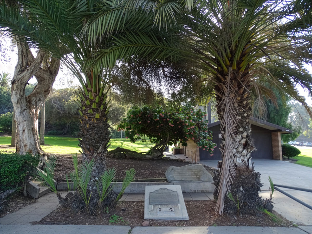
 California Historic Landmark (CHL) No. 67, the Serra Palm Site. Two recently planted date palms straddle the bronze landmark plaque, which was installed seven years before the last surviving original date palm—said to have been planted by Father Junípero Serra—died and was removed in 1957. Location: northwest corner of Presidio Park along Taylor Street, east of Chestnut Street, San Diego. Photo by Alex D. Bevil |
California Historic Landmark (CHL) No. 67, Serra Palm Site
Located near the northwest corner of Presidio Park, this monument was originally designated on December 6, 1932 as the 1770 jumping off point of El Camino Real (The King’s Highway), connecting San Diego to Monterey. The California Centennials Commission and the San Diego County Historical Markers Committee dedicated this bronze monument on September 2, 1950.
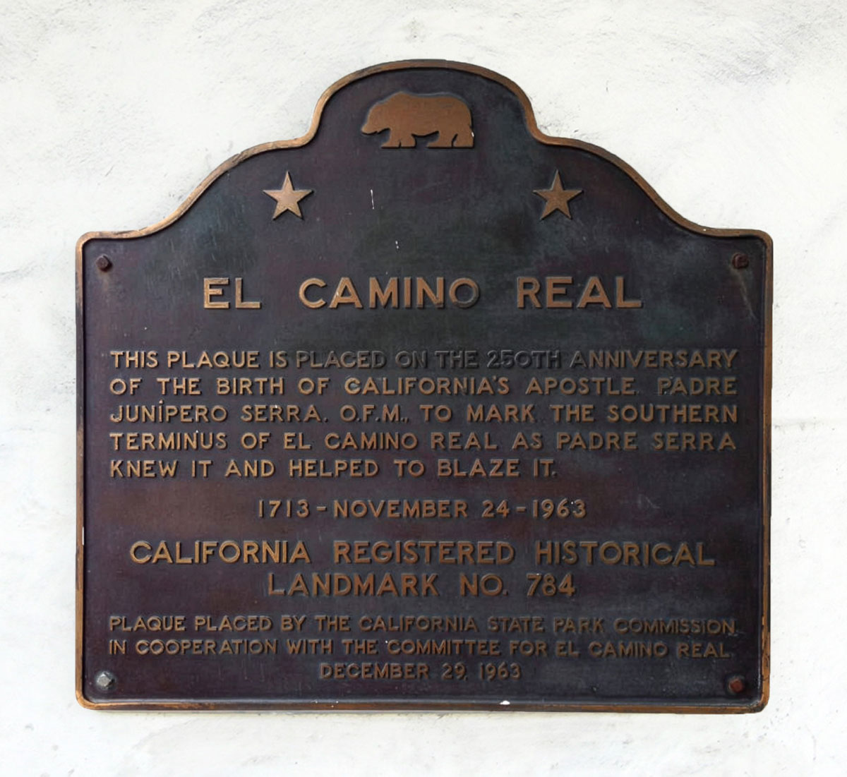
CHL No. 784, El Camino Real
Dedicated on December 29, 1963, this plaque, a copy of one placed earlier at San Francisco’s Mission Dolores, was erected at Mission San Diego de Alcalá to commemorate Saint Junípero Serra’s 250th birthday. The plaque erroneously states that it marks the southern terminus of “El Camino Real as Padre Serra knew it and helped to blaze.” In actuality, the road’s southern terminus was at Mission Loreto in Baja California. Also, Governor Gaspar de Portolá, along with Captain Pedro Fages, Father Juan Crespí, and others, did most of the trailblazing, while Serra stayed in San Diego before relocating by ship to Monterey in 1770.
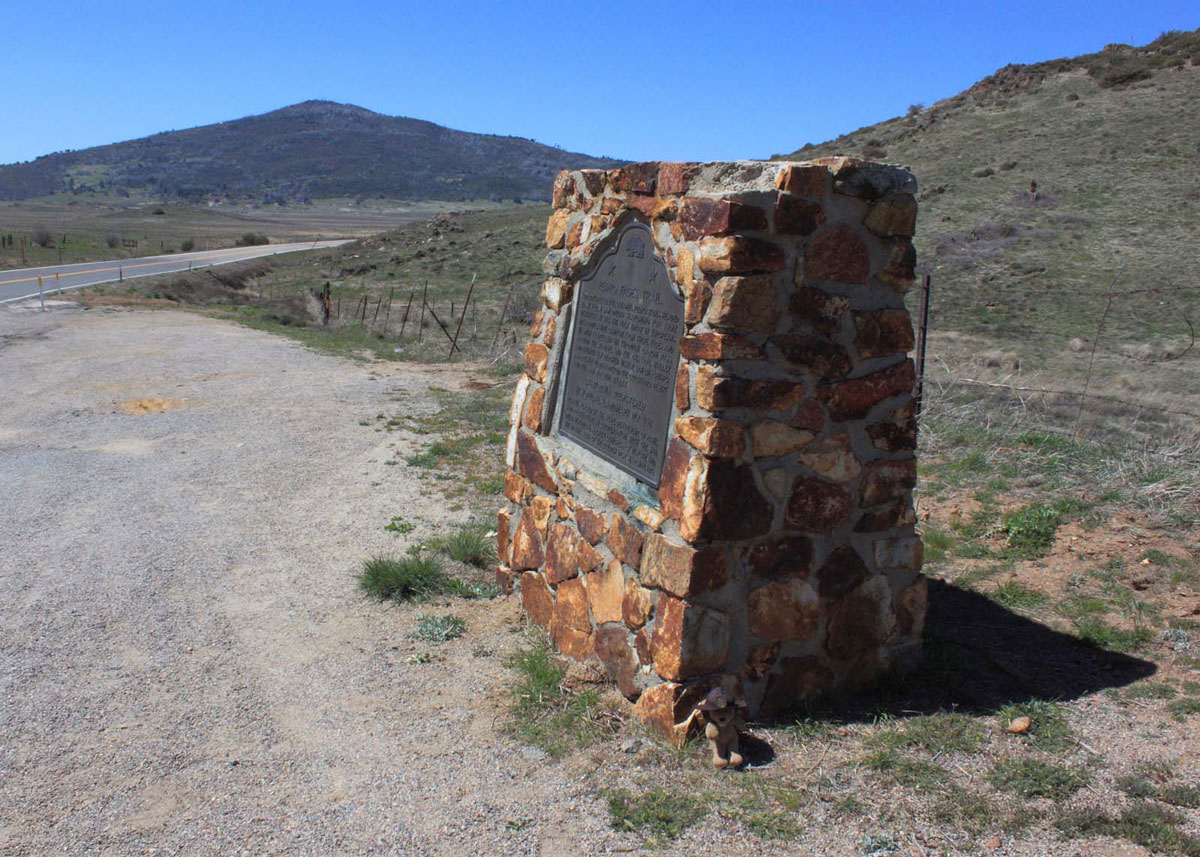
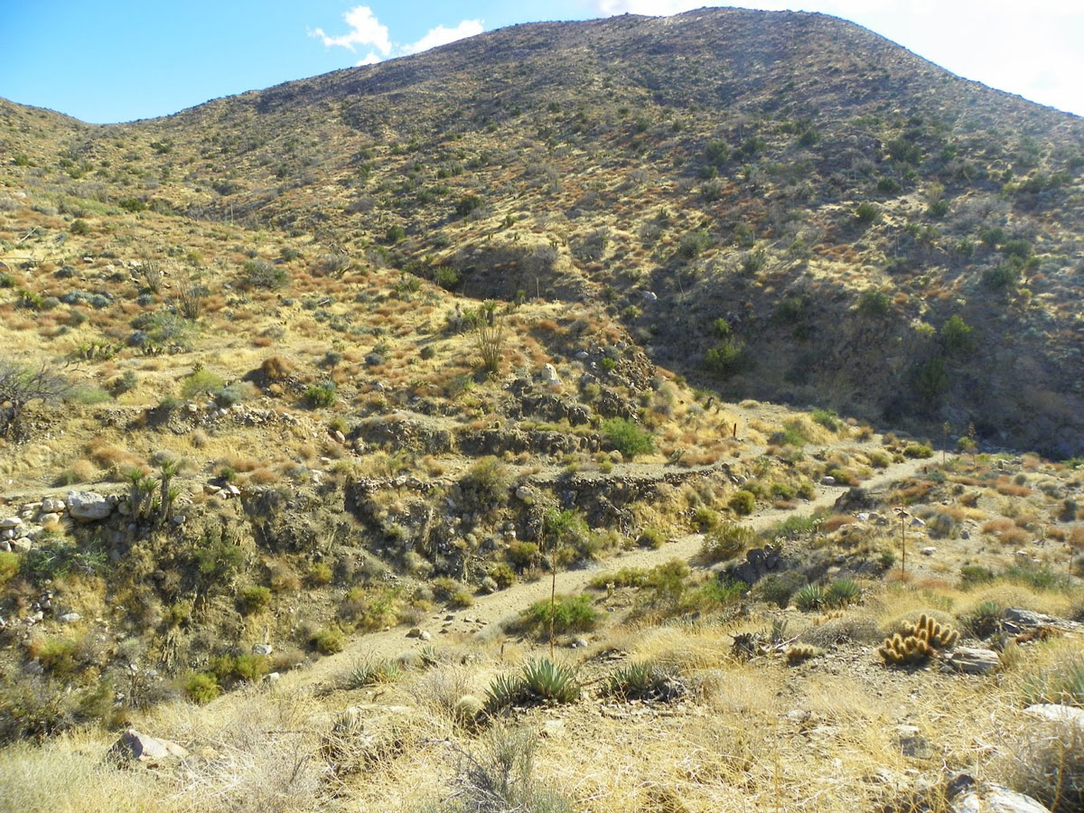
CHL No. 858, Pedro Fages Trail
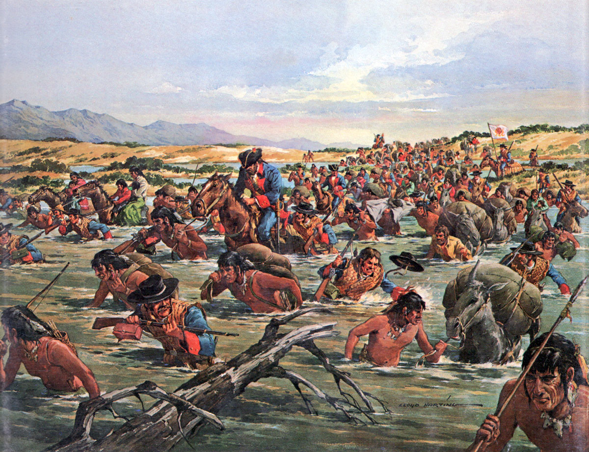
At this spot off County Road S1, 1.7 miles southeast of the Sunrise Highway, on October 29, 1772, Colonel Pedro Fages, following Native trails, led the first group of Europeans down Oriflamme Canyon from what is now Cuyamaca Rancho State Park into today’s Anza-Borrego Desert State Park. Two years later, Captain Juan Bautista de Anza utilized sections of the Fages Trail. Traveling west in 1781, both men proved the viability of overland routes from Mexico to settle and supply Alta California.
Note: The following CHLs are in Anza-Borrego Desert State Park.
CHL No. 304, Vallecito Stage Station
The site, now associated with the National Register-listed Fages-De Anza Trail-Southern Emigrant Road, is where Governor Fages located a spring in 1782. It would become a welcome stop for desert travelers. Another nearly identical monument sits near Scissors Crossing, the intersection of Highways S2 and 78. In 1956, the San Diego County Board of Supervisors and the Historical Markers Committee erected the former, while the County Division of Public Works, Division of Highways erected the latter monument.
CHL No. 635, Los Puertecitos
While traversing sections of the Fages Trail, in 1774 Captain Juan Bautista de Anza and Father Francisco Garcés opened an overland trail from Sonora, Mexico to Alta California. On December 19, 1775, Colonel Anza led some 240 civilians through this pass of “Little Doors.” Accompanied by their livestock, many would become San Francisco’s first civilian residents. The California State Park Commission and the Native Sons of the Golden West erected this monument 1.6 miles east of Ocotillo Wells along Highway 78 on January 31, 1959.
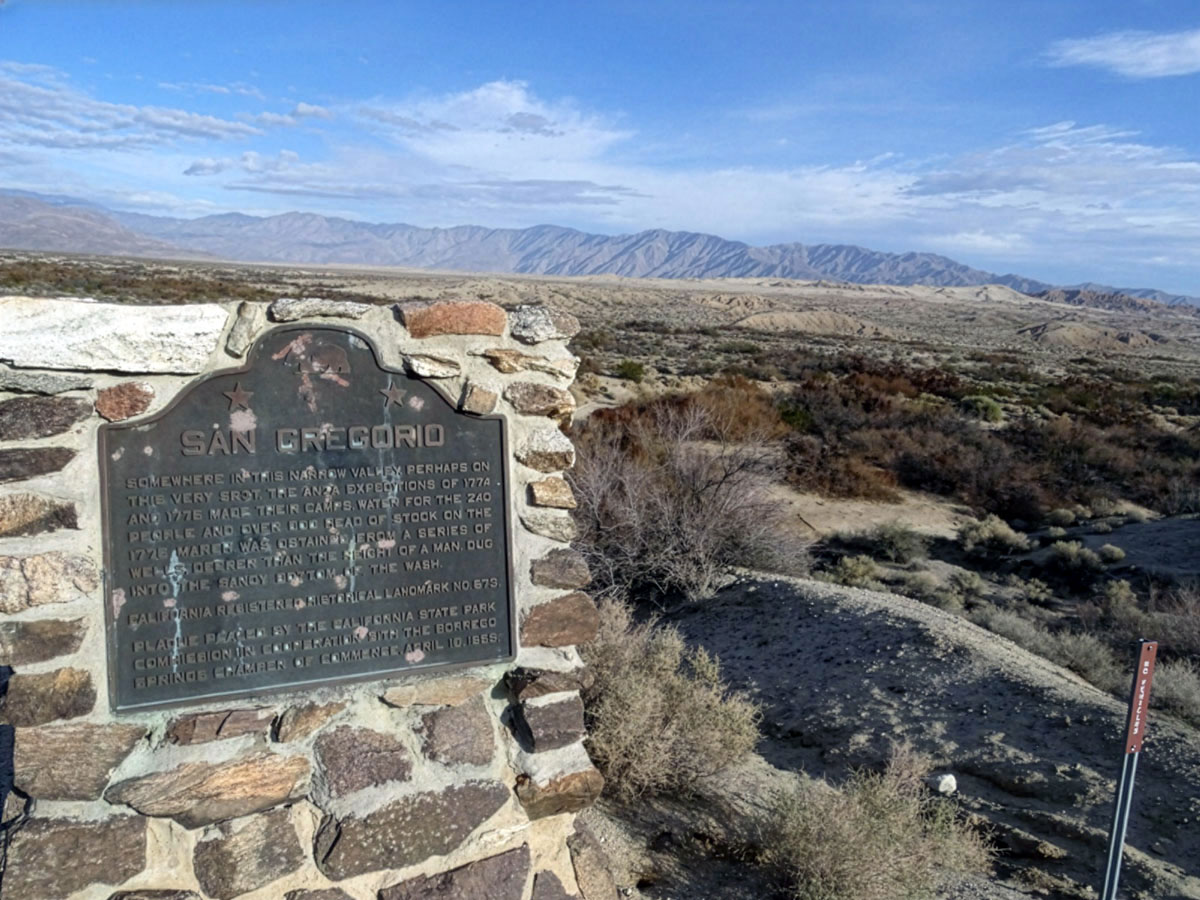
CHL No. 673, San Gregorio
The Borrego Springs Chamber of Commerce, in cooperation with the California State Park Commission, designated the site that inspired the town’s name on February 16, 1959. Standing three miles southeast of Palm Canyon Drive and Pegleg Road, it marks the site where both the 1774 and 1775 Anza Expeditions utilized wells dug into the wash to water people and livestock.
CHL No. 634, The Anza Trail / El Vado
This monument marks where the second Anza Expedition camped on December 20-22, 1775 before crossing a ford (el vado) at the mouth of Coyote Canyon. At this point the party began climbing the arduous San Ysidro Mountains. On March 3, 1958, the California State Park Commission and the Kiwanis Club of Borrego Springs erected the monument about three miles north of Henderson Canyon Road on Horse Camp Road.
CHL No. 785, Santa Catarina
On December 23, 1775, Anza described this fresh water source as “a spring or fountain of the finest water [where] at its head we halted for the night. Located about 1.3 miles northwest of El Vado, at the crest of a bone-jarring, four-wheel-drive track, the Squibob Chapter of E Clampus Vitus assisted in erecting a marker on April 20, 1963.
CHL No. 639, Palm Spring
On October 6, 1958, the Fremont-Kearny Historians of Old San Diego placed this monument approximately 1.3 miles east of the intersection of County Road S2 and Vallecito Creek Road. This palm-studded desert spring provided a welcome resting place for soldiers and settlers traveling along the De Anza-Southern Emigrant Trail, one of the most traveled routes in California’s early settlement and development.
CHL No. 472, Box Canyon
Located off County Road S2 at milepost 25.7, this monument was erected in 1953 by the San Diego County Supervisors and Historical Markers Committee at the end of a primitive dirt trail overlooking a narrow gully. The rocky walls of the gully still bear evidence of where, on January 19, 1847, members of the Mormon Battalion, under the command of Lieutenant Colonel Philip St. G. Cooke, used hand tools to hack out what would become one of the most important overland stage routes into Southern California.
CHL No. 647, Butterfield Overland Mail Route
Various military and civilian emigrant groups used this important transitional pass (La Puerta) between the lower desert and the cooler mountain valleys to the north. The California State Park Commission and Sierra Club erected this monument on October 6, 1958, half a mile east of County Road S2 along Highway 78 in Blair Valley. Nearby is evidence of tracks left by the Butterfield Overland Mail coaches.
CHL No. 793, San Felipe Valley and Stage Station
Dedicated on April 19, 1964 by the California State Park Commission and the Squibob Chapter No. 1853 of E Clampus Vitus, this monument is one of the few landmarks that recognizes that “explorers, trappers, soldiers, and emigrants crossed ancient trade routes of Kamia, Cahuilla, Diegueño, and Luiseño Indians.” Situated half a mile northwest of Highway 78 on San Felipe Road, it was also the site of a Butterfield Overland Mail station from 1858-1861.
BACK to table of contents
Read the rest of the ongoing Hiding in Plain Sight Series.
|
2026
2025
2024
2023
2022
2021
2020
2019
2018
2017
2016
2015
|