|
¡Tierra a la Vista! (Land Ho!)
Maritime-Related State Historic Landmarks
Hiding in Plain Sight - Part 2
By Alexander D. Bevil, California State Parks Historian II (Retired)
January/February 2026
California Historic Landmark (CHL) No. 56 is one of three state monuments at the end of Rosecrans Street in Naval Base Point Loma, close to where Spanish explorer Juan Rodríguez Cabrillo landed on September 28, 1542 to take possession of the port of San Miguel. Sixty years later, Spanish explorer-soldier, Sebastián Vizcaíno, named the site La Punta de Guijarros because of all the washed-up stones that would later be used as ships’ ballast. He also inexplicably renamed the port San Diego.
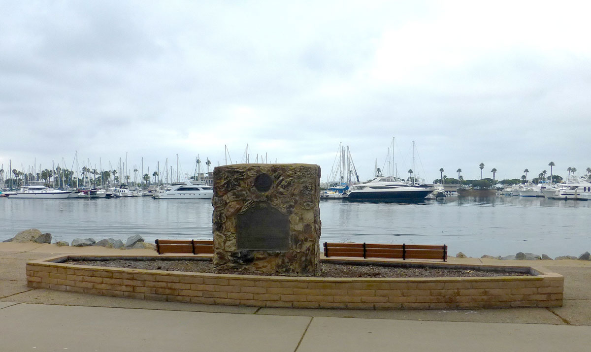
Some 3.5 miles to the northeast, between N. Harbor Drive and Harbor Island, is CHL No. 891, Spanish Landing. The plaque reads, the:
… sea and land parties of the Portolá-Serra expedition met in 1769. Two ships, the San Antonio and San Carlos, anchored on May 4-5 and the scurvy-weakened survivors of the voyage established a camp, where on May 14 and July 1 they greeted the parties coming overland from Baja California. Together, they began the Spanish occupation of Alta California.
 CHL No. 891. Spanish Landing monument. Members of the Squibob Chapter, along with California State Parks and the San Diego Unified Port District, erected and dedicated this marker in the eponymously named park on May 8, 1976. Photo by Alex Bevil |
While the two ships might have anchored near this spot, the camp may have been located on dryer land (See CHL No. 57 below, La Punta de Los Muertos). It was more a field hospital and a cemetery for 21 scurvy victims, whose bodies were relocated to the foot of what is now Presidio Hill. The land expedition’s second group joined the first crew’s remaining members on July 1, 1769.
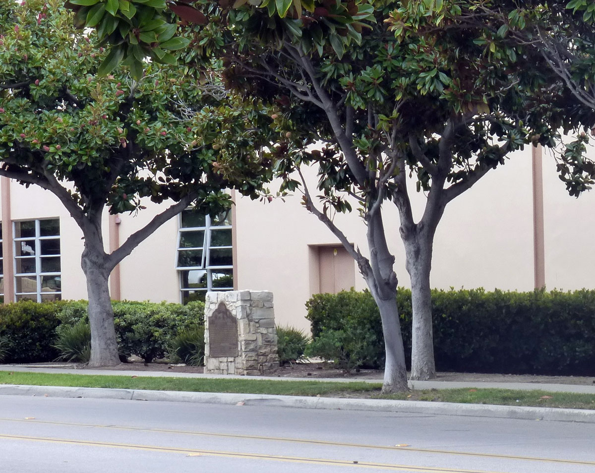
Two months earlier, on May 1, mariners using one of the ship’s launches entered an inlet about a mile to the north to find fresh water. A wharf or desembarcadero was later erected to transfer people and goods via the nearby La Playa Trail to or from the presidio and later the pueblo of San Diego. Silted up by 1789, the wharf site is now buried under nine feet of dirt fill. Designated CHL No. 64 on December 6, 1932, the current El Desembarcadero monument can be found along Farragut Road adjacent to High Tech High International.
Two miles to the southwest, at the northern entrance to Naval Base Point Loma, is CHL No. 61. From 1770-1870, La Playa, or the Beach, was San Diego’s busy deep-water anchorage. Known facetiously as “Hide Park,” it was an active cow hide storage and shipping center prior to the Mexican War. During the war, on July 29, 1846, sailors, marines, and California Battalion volunteers from the USS Cyanne landed and proceeded along La Playa Trail to occupy the San Diego pueblo. Later, the navy acquired the site, where it established early refueling, quarantine, and radio stations.
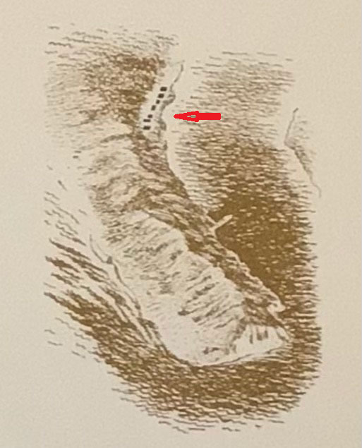
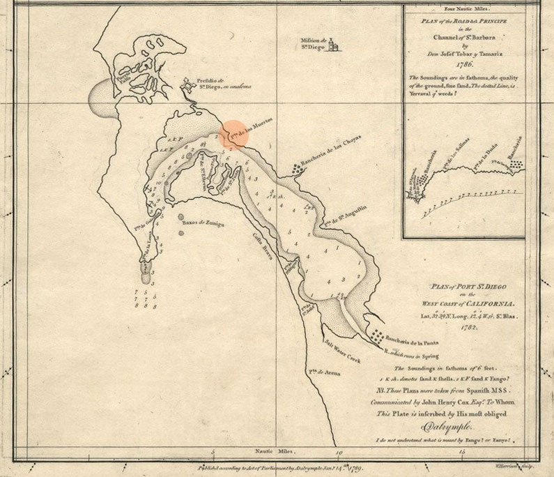
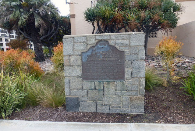
Situated on the southeast corner of Market Street and Pacific Highway, next to the former San Diego police headquarters is CHL No. 57, La Punta de Los Muertos, or Dead Men’s Point. According to its plaque, it marks the …
Burial site of sailors and marines in 1782 when San Diego Bay was surveyed & charted by Don Juan Pantoja y Arriaga, pilot, and Don José Tovar, mate, of the royal frigates "La Princesa" and "La Favorita" under command of Don Agustín de Echeverría.
However, according to Pantoja’s log, assistant pilot Simón Soravia had replaced an incapacitated second pilot Don Tovar. In addition, while Pantoja did name the site La Punta de Los Muertos (Dead Men’s Point) on his map, he never mentioned in his log that any of the ships’ crew had died, much less been buried there.
Decades later, San Diego’s pioneer real estate developer William Heath Davis may have originated the site’s misinterpretation. Reminiscing about his abortive attempt to found “New San Diego” in 1850, he stated that “several sailors and marines died and [were] interred on a sandspit adjacent to where my wharf [once] stood and was named [La Punta de los Muertos].”
So, the inscription on CHL No. 57’s plaque is a textbook example of “When the legend gets in the way of the facts, print the legend.”
CHL No. 69, the site of Fort Guijarros, is the second landmark monument in the naval base at the end of Rosecrans Street. Noted Spanish Royal Engineer Alberto de Córdoba designed El Castillo de San Joaquín in 1794. Its ten cannons fired six-pound cannon balls from its crenellated cobblestone-and-adobe walls at two American ships trying to smuggle contraband out of the harbor in 1803 and again in 1828. In 1846, marines from USS Cyanne captured and used the guns against Mexican forces defending San Diego. The site has undergone extensive archaeological scrutiny.
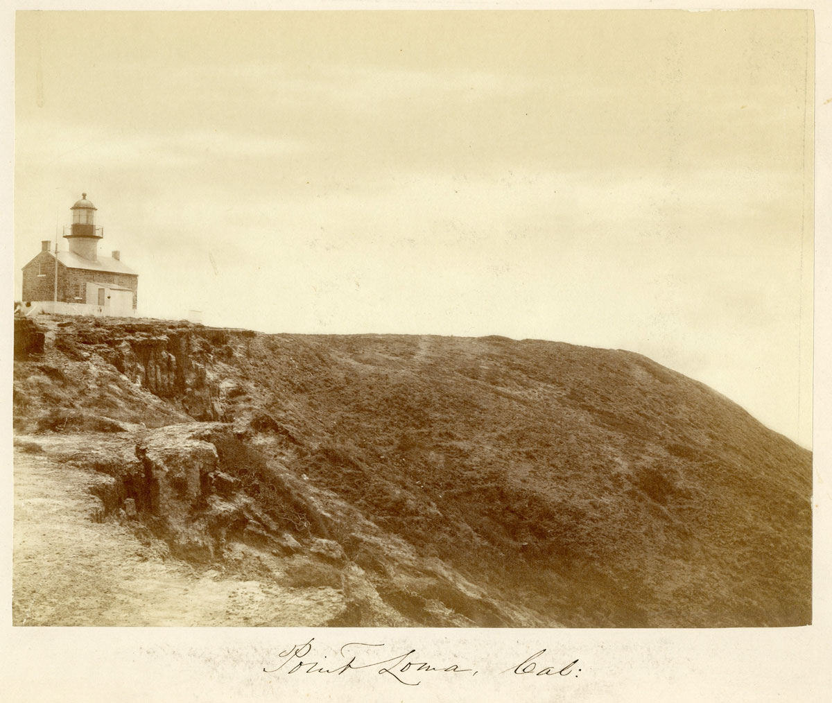
While a pole-mounted lantern stood at the tip of Ballast Point sometime between 1806 and 1810, San Diego’s first official lighthouse was built on much higher ground about half a century later. In operation in 1854, it was one of eight Cape Cod style lighthouses that the United States government erected along the West Coast. Erroneously referred to as “The Old Spanish Lighthouse,” it was deactivated, abandoned, and replaced in 1891 by the current lighthouse closer to sea level. Two years after the Cabrillo National Monument’s 1913 dedication, a nascent historic preservation movement succeeded in preventing the demolition and replacement of the first lighthouse with a giant statue of Cabrillo. During extensive renovation work between 1931 and 1935, it became CHL No. 51 Old Point Loma Lighthouse.
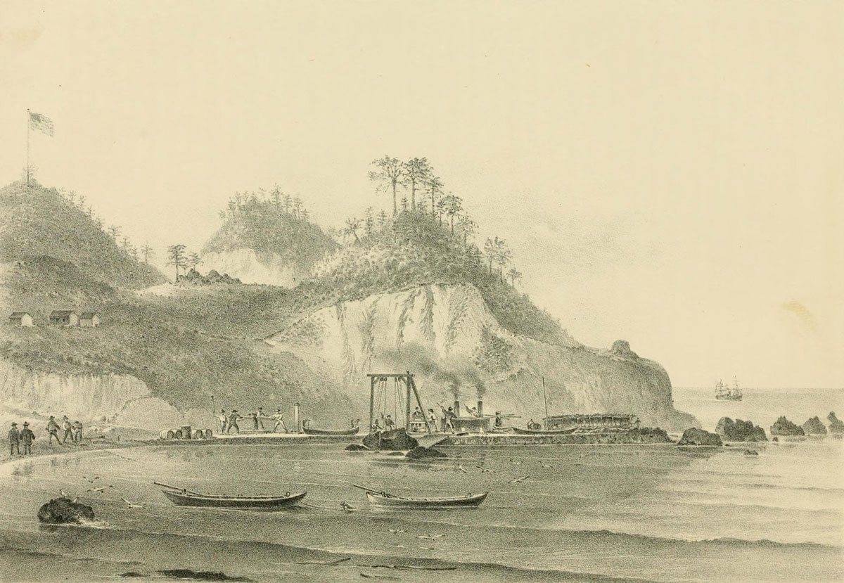
The third landmark monument at the end of Rosecrans Street in the naval base is CHL No. 50. The Ballast Point Whaling Station is reportedly the sole known example of a well-documented shore whaling station site in the United States. Established in 1857, its two American-owned whaling companies’ workforce included ethnic African, Chinese, Portuguese, and Pacific Islanders. However, by 1873 most of the coastal whale herds had been hunted to near extinction. The U.S. military’s acquisition and eventual placement of a 15-gun coastal defense artillery battery for Fort Rosecrans removed all above-ground evidence of both the whaling station and nearby Fort Guijarros.
BACK to table of contents
Read the rest of the ongoing Hiding in Plain Sight Series.
|
2026
2025
2024
2023
2022
2021
2020
2019
2018
2017
2016
2015
|